You might not associate the phrase “advanced geospatial analysis” with conservation, but the Chesapeake Conservancy is out to change that. In fact, if you want to geek out on high-tech conservation, the Conservancy’s artificial intelligence (AI) and advanced datasets may be right up your alley.
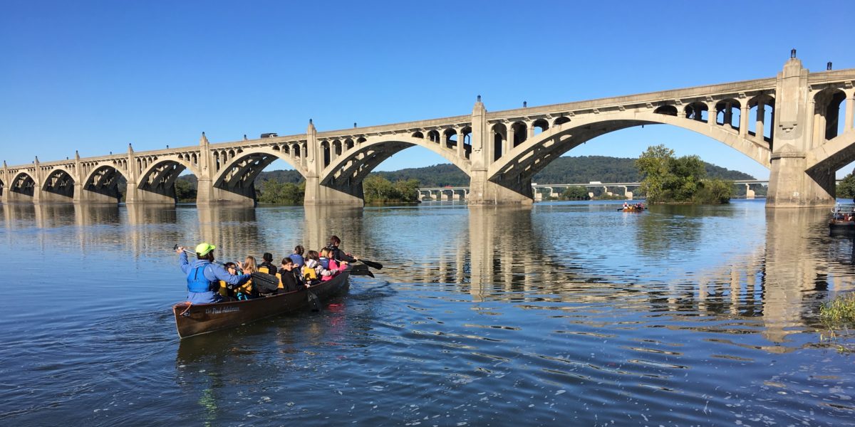
Based in Annapolis, MD, the Chesapeake Conservancy is a group of “conservation entrepreneurs” who, in addition to building parks, trails, and public access sites (the Conservancy has helped build 206 public access sites to date), use technology to enhance the pace and quality of conservation. Specifically, the Conservancy uses AI and large-scale precision mapping to speed progress in conserving landscapes vital to the Chesapeake Bay’s health and cultural heritage.
Part of the Precision Conservation Movement
With its data-driven philosophy, the Chesapeake Conservancy is part of a larger movement called “precision conservation.” When it comes to planning and implementing conservation projects, this movement has been described as using a scalpel rather than a knife. “Precision conservation redefines how land conservation is approached,” notes Michael Bowman, Chesapeake Conservancy’s Partnership Communications Coordinator. “When we can be very surgical about our programs, this makes environmental goals more achievable.”
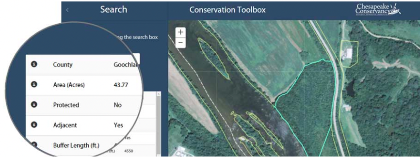
The Conservancy’s precision conservation work is done through its Conservation Innovation Center (CIC). One of the CIC’s recent projects is dramatically improving the level of detail of its GIS mapping. This new, highly detailed dataset allows a much deeper understanding of what’s happening on the ground.
“In most cases, when you do geospatial mapping, you can only get so detailed,” says Bowman. “Typically, that is 30 meters to every one pixel. Working with a variety of partners, however, the CIC has been able to bring that down to one meter for every pixel. The result is a level of accuracy that is 900x greater than the datasets used by most conservancies. We can look at watersheds, wetlands, or swamps, and detail the topography and land features with precision never before possible.”
The advanced geospatial mapping also allows conservationists to add layers, such as trees, impervious surfaces, roads, and farms, that allow them to create more detailed recommendations for local, statewide, and even national projects. And unlike the national datasets that are updated every few years, the Chesapeake Conservancy’s dataset is updated continually.
Precision Canopy Mapping and Rooftop Solar Farms
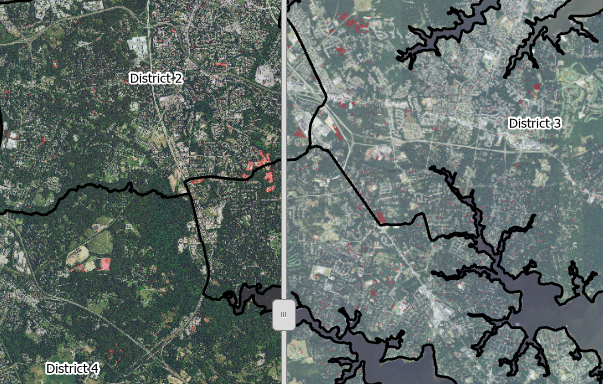
How is the CIC putting this data to use? One of its current projects is creating an analysis and protection plan for the tree canopy in Anne Arundel County, MD. Using geospatial mapping, the CIC discovered that the county has been losing more trees than any other county in the state. “With the new mapping capabilities, the CIC team was able to precisely document this loss in tree canopy, along with all of the associated environmental dangers, such as increased runoff, more instances of flooding, and a significant increase in the urban heat island,” explains Bowman. “This led to the enactment of a new law in Anne Arundel County (Bill No. 68-19, Forest Conservation Bill), which establishes special priority retention areas and modifies land conservation targets, among others.”
Another project close to the CIC’s heart is identifying the optimal sites for a new solar field. Maryland is one of 30 U.S. states with a mandate to increase electricity production from renewable energy sources. Working with the city and county of Baltimore, the CIC developed a plan, “Optimal Solar Siting for Maryland: A Pilot for Baltimore County and City,” to aid in identifying the best locations.
“Maryland’s mandate requires 50% of electricity sold by utilities to come from renewable sources, with 14.5% from solar,” says Bowman. “To meet this goal, the state will need six times the solar energy production than it has now. With advanced geospatial mapping, we can examine many previously overlooked opportunities for solar placement, such as on degraded lands and underutilized industrial sites—even on the rooftops of commercial, industrial, and residential buildings.”
With the rate of urbanization, these technological advances could not have come at a better time. “The Chesapeake Bay watershed is a natural treasure and needs to be conserved,” Bowman concludes. “Hundreds of years ago, trees were everywhere. Developments were smaller. The rate of urbanization was slower. Now the Bay is so developed that there is a tremendous sense of urgency. The clock is ticking.”
To learn more about the work the Chesapeake Conservancy is doing and get involved, visit them at chesapeakeconservancy.org.
Sustainably,
Bobby Firestein
For our 2022 Ecoprint calendar, Protecting the Natural Beauty of the Chesapeake Bay, we have partnered with 13 different organizations, all dedicated to helping solve the environmental challenges in this important ecological hub.Chesapeake Conservancy is our featured partner for the month of August. To get your own 2022 Ecoprint calendar, click the button below.